Drone Surveillance for Pedestrian Detection
We experimented and trained deep CNNs (RetinaNet, YOLO) for pedestrian detection using Stanford Drone Dataset.
Technologies used: Keras, Tensorflow, Google Colab, Python 3.6 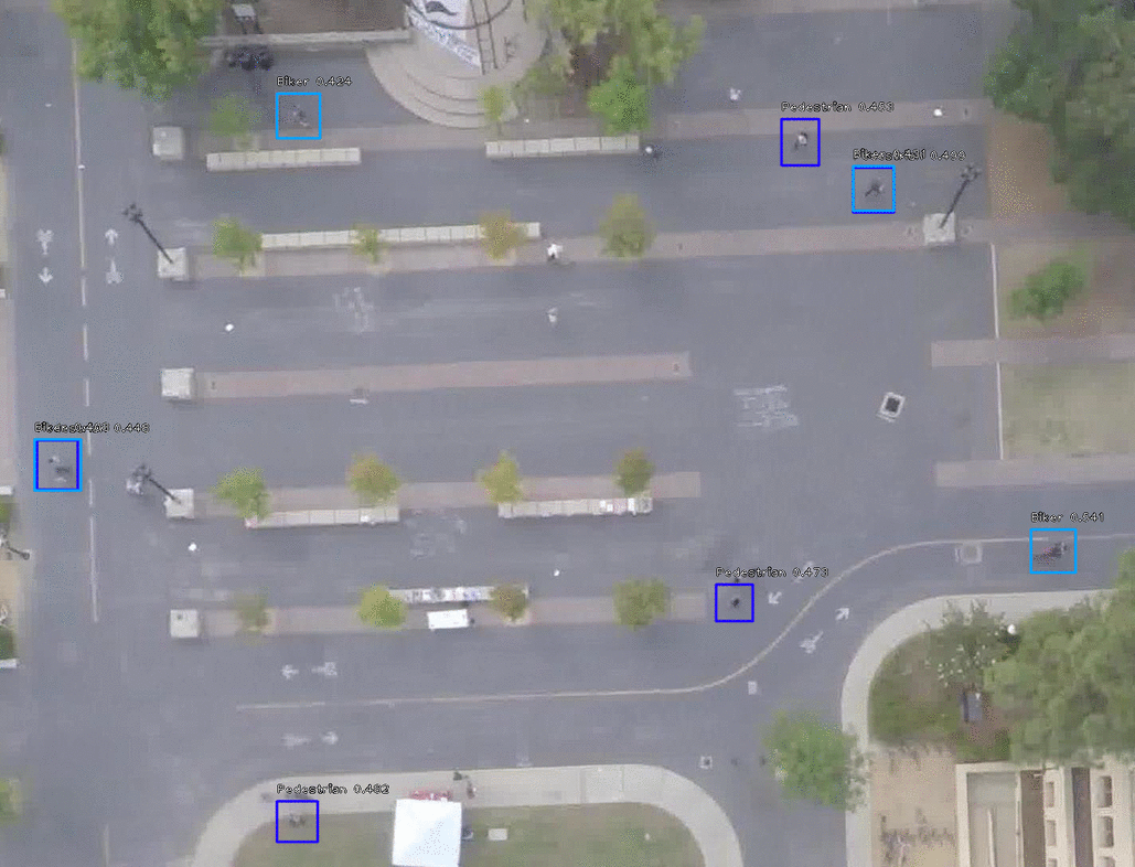

We experimented and trained deep CNNs (RetinaNet, YOLO) for pedestrian detection using Stanford Drone Dataset.
Technologies used: Keras, Tensorflow, Google Colab, Python 3.6
It is a software for object detection in rural areas using satellite images from Google Map.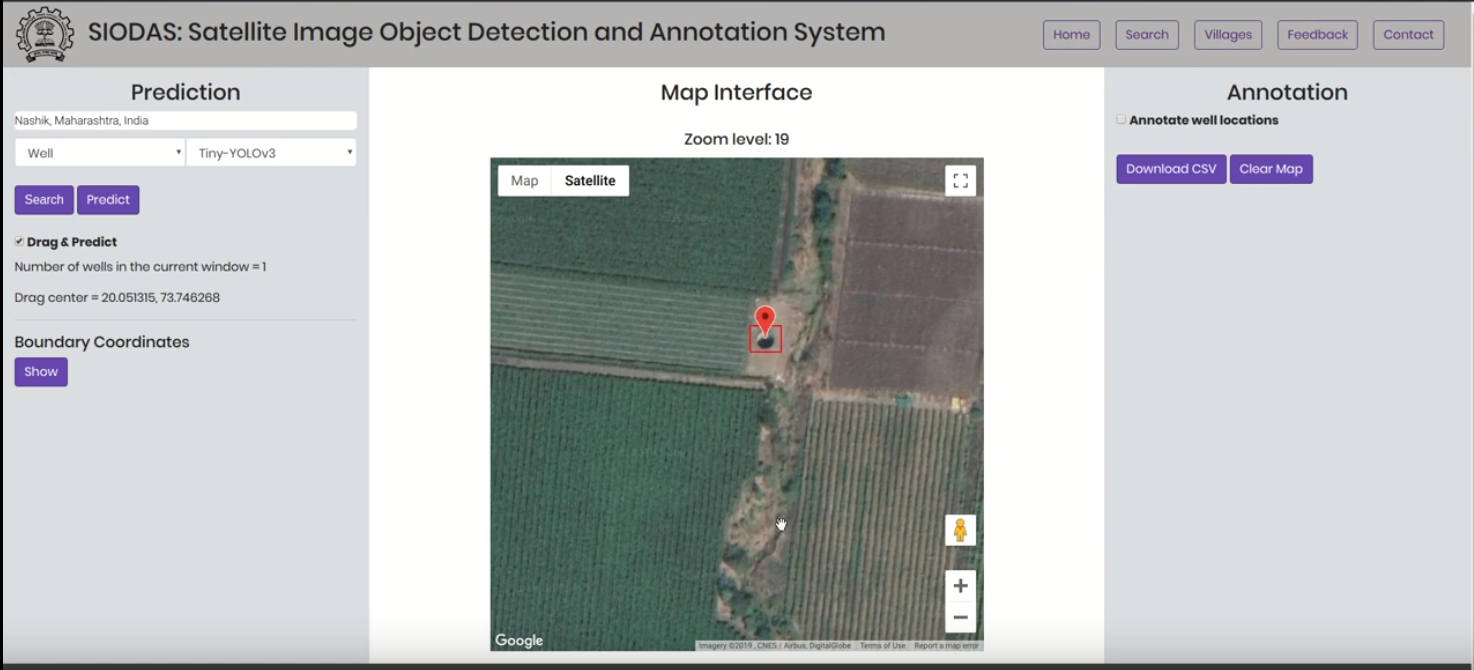
This project is based on the detection of relevant texts from a document given an input sentence and then to find out whether those texts are supporting, opposing or neutral to the input sentence.
Published in Forum for Information Retrieval Evaluation, 2010
In this paper, we describe the methodology used and the results obtained by us for completing the tasks given under the shared task on Consumer Health Information Search (CHIS) collocated with the Forum for Information Retrieval Evaluation (FIRE) 2016, ISI Kolkata. The shared task consists of two sub-tasks-(1) task1: given a query and a document/set of documents associated with that query, the task is to classify the sentences in the document as relevant to the query or not and (2) task 2: the relevant sentences need to be further classified as supporting the claim made in the query, or opposing the claim made in the query. We have participated in both the sub-tasks. The percentage accuracy obtained by our developed system for task1 was 73.39 which is third highest among the 9 teams participated in the shared task.
Download here
Published in Proceedings of the 5th International Conference on Geographical Information Systems Theory, Applications and Management (GISTAM), 2019
The Government of India conducts a well census every five years. It is time-consuming, costly, and usually incomplete. By using transfer learning-based object detection algorithms, we have built a system for the automatic detection of wells in satellite images. We analyze the performance of three object detection algorithms - Convolutional Neural Network, HaarCascade, and Histogram of Oriented Gradients on the task of well detection and find that the Convolutional Neural Network based YOLOv2 performs best and forms the core of our system. Our current system has a precision value of 0.95 and a recall value of 0.91 on our dataset. The main contribution of our work is to create a novel open-source system for well detection in satellite images and create an associated dataset which will be put in the public domain. A related contribution is the development of a general purpose satellite image annotation system to annotate and validate objects in satellite images. While our focus is on well detection, the system is general purpose and can be used for detection of other objects as well.
Download here
Published:
This is a description of your talk, which is a markdown files that can be all markdown-ified like any other post. Yay markdown!
Published:
This is a description of your conference proceedings talk, note the different field in type. You can put anything in this field.
Undergraduate course, University 1, Department, 2014
This is a description of a teaching experience. You can use markdown like any other post.
Workshop, University 1, Department, 2015
This is a description of a teaching experience. You can use markdown like any other post.